One reason we had so many early storms was the warmer than usual waters of the Gulf of Mexico.
During winter 2011-2012 the Arctic Oscillation kept much of the polar cold bottled up north of the 75th latitude (except for the "gate" opening onto central Europe, with upwards of 1000 people frozen to death in Jan.-Feb.)
The second reason was the lingering La Niña which has teleconnection effects on the jet stream which seem to set up temperature gradients and wind shear conducive to storm formation.
The 1974 Super outbreak and the 2011 season which saw the EF-5 devastate Joplin Mo. occurred during La Niña.
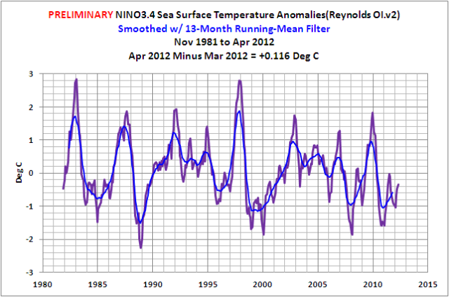
As the Climate Observations blog points out, the water in the Niño 3.4 area has warmed to the point that it is barely "La Niña Conditions" much less a full-blown La Niña:
Based on the preliminary data, monthly NINO3.4 SST anomalies are at -0.35 deg C. The 2011/12 La Niña has come to an end....

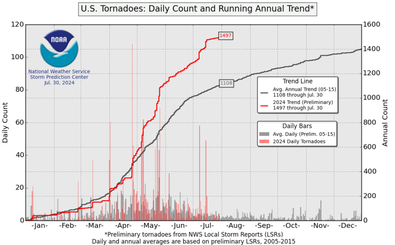
All of this has resulted in a reversion to the mean for 2012:

This does not mean insurers can relax, hurricane season starts in thirteen days and La Nada, especially for southern Florida, can be quite nasty. The two most expensive storms in Florida history, the 1926 Great Miami Hurricane and 1992's Hurricane Andrew occurred during La Nada periods.
Throw in the situation in the Gulf of Mexico and this could be an interesting summer.
